
Tuesday, August 11, the winds were whipping around in the marina this morning and were predicted for the day. We could see white caps out on the bay in front of the marina. Hey! We gotta “free day!” What to do…what to do!
We both made good use of the day. In the morning I rearranged our food storage so we could de-clutter the salon/galley area. Wayne, meanwhile, walked into town to check out the hardware…then down to what looked like a lighthouse (turned out to be a light house-looking addition to a house. ;-)
In the afternoon I walked into town to visit the library, which is attached to the elementary school. Wayne, meanwhile, worked a while in the engine room.
That evening the sunset was struggling behind a few remaining clouds...

Sault Ste. Marie, MI, George Kemp Marina, August 12, 2015
On Wednesday, August 12, the weather looked great and we traveled up the St. Mary’s River to Sault Ste. Marie and the George Kemp Marina. As we left De Tour Harbor the birds were all out to see us on our way...Look closely and you'll see one on almost every post. And if they got there late, they had to resort to being on the dock.


It was an enjoyable trip because it was a beautiful day and we had lots to keep us entertained, visually...

There are two channels going through the St. Mary's River. Our chart plotter catches both in this image: the "down" channel is on the left side...and the "up" channel on the right (we're the black vessel with the red circle around it. We look pretty imposing on the chart! ;-)

This is a typical lunch when we're on the move: salami, cheese, and crackers.

Here we are coming into Sault Ste. Marie and looking towards the Soo Locks.

The Canadian side (they have a Sault Ste. Marie, too) is a bit more enticing than the U.S. side from the water...

We refueled as we entered the marina. As we were securing the boat at the dock we noticed a boat named MARBLES on the other side of the marina. Hey, we’ve seen that boat before!Actually, we’d seen the boat as it left De Tour, but we knew the boat when it was owned by Tom and Sue Jones back in the 2008 trip. Segue and Marbles were in the “great flood of the Illinois River” that year…part of the River Rats, as we were dubbed. ;-) We saw Sue and Tom in Florida this year as we passed through.
Anyway, when we’d seen the boat at De Tour we called Tom and told him we’d spotted his boat! He said if we saw it again he’d like the contact info for new owner. So before heading into town for a grocery run, we walked over and introduced ourselves to the new owner…and swapped info on the previous owner (one removed). ;-)

From our slip in the marina we had a good view of the ships going in and out of the locks.


Our first order of business there was to collect all the mail we had sent to Sault Ste. Marie. We had a cart load of boxes and envelopes…dog food for Lucy being the largest items (2 cases). Ah. Keep the pup happy!
Needing a few supplies, we asked directions from the marina staff for nearby grocery and were given directions. Long story short, it was quite a walk. The trip took us down Water Street...and eventually across the St. Mary’s River, which was zooming through!


Whitefish Point State Dock, Whitefish Point, MI, August 13.
There are four locks up at Sault Ste. Marie…two US and two Canadian.
We had checked on locking through the Soo Locks (as they are called here) the night before and had determined that the lock called the “Canadian Canal” was best for pleasure boats because it is smaller. Here we are the morning of the 13th...waiting our turn to enter. There were 2 motor cruisers and a sailboat on the starboard side with us as the last to enter...and a tour boat on the port side.


As we left the lock and passed by the industrial sites on the Canadian shore...we were holding our breathe for the first glimpse of Lake Superior!

We had an easy day of travel to Whitefish State Dock. There are 4 slips available there for transients. The other slips are reserved for the fishermen from the nearby Indian reservation. Two of the slips were already occupied when we got there, by two of the pleasure boats from Soo Locks.
Talk about remote! But beautiful! No facilities except a port-a-pottie...no electric or water. The docks are wooden....and exposed to the wind, so there's a sign at the beginning of the dock leading out to the boats warning of waves that can crash up on the dock walk. Got it!
We took a walk around with Lucy...and checked out the beach area for stones.


Walking back along the dock we took closer notice of the fishing boats there.

Love the name on this blue one: Eat More Fish!

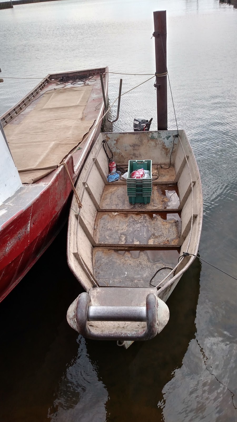
I decided this all metal beauty would be the perfect boat for me to scurry around in on the lake. ;-) I'm thinking I could use one of the plastic boxes for a seat...
On Friday, August 14, we left Whitefish Point as the fishermen were getting ready to go out. The skies looked a little cloudy and grey...and a thunderstorm went through early in the morning. We checked out the weather and it looked like spotty showers throughout the day. We had a place between Grand Marais, MI, our destination, and Whitefish: Little Lake. Reviews on Active Captain had indicated heaving shoaling at the entrance...but we talked to a young man we met while walking yesterday and he said we could count on 8 ft. at the entrance. If we feel like the storms are getting too bad, we could try that anchorage.
We skirted showers on the lake all day, but had an easy ride down to Grand Marais.


Large sand dunes lined the shore as we left Whitefish. Looked like they'd be fun to slide down!

We listened to the radio for a while today until it started acting up... Wayne's fixing it. ;-)

And then I noticed the "dashboard" and thought it needed to be preserved in picture. Let's see...glasses, up to 3 or 4 pair, depending on the day, will be parked there. Our PLB (Personal Locator Beacons) so if we need to abandon ship (or if we fall overboard) we can send out a signal as to our location. We usually try to carry that and wear a life preserver whenever we're going off the bridge while traveling. Our handy, dandy gadget made by Steve Smith to remind us of how we should be oriented in the channel: "red right returning!" Behind that is the most functional fly swatter we've ever had....and that's saying a lot! ;-) It's all plastic, just right for pulling back on the slapper and letting it GO! on an unsuspecting fly or other insect varmint. It's inscribed: Mug a Bug on the Erie Canal." Oh, and there's the little white remote for the radio that Wayne fixed. Radar, chart plotter, depth finders, autopilot, gauges, radios...ya da ya da.

We anchored in the bay at Grand Marais, near the town beach in 29ft.

The beach was made up of very soft sand...so we gathered a lot on ourselves and Lucy as we trucked up from the shore to the town. ;-) There was a music festival going on that weekend and the little town was humming with activity. There's a small marina here and a campground, and it seemed the festival was centered in the campground.
Passed the Pickle Barrel House Museum...decided it wasn't on our list of activities for the afternoon.


For a while, we were the only boat anchored just behind a small mooring field of sailboats. That evening, though, another trawler, MITZVAH, anchored nearby. The music from the festival started up at 9 PM and we could hear it a little down in the bay...but it didn't keep us from a good night's sleep!
Next day, Saturday the 15th, we traveled down to Munising, MI. This was the section of Lake Superior we really wanted to see, the Pictured Rocks. The coastline between Grand Marais and Munising has miles of these unusual rocks. From the National Park Service web site,
http://www.nps.gov/piro/faqs.htm
What are the Pictured Rocks?The Pictured Rocks are sandstone cliffs rising 50 to 200 feet directly up from Lake Superior. The cliffs begin just east of Sand Point and stretch for about 15 miles. Mineral seepage creates the colors. Red and orange are iron, green and blue are copper, black is manganese, and white is lime.We'd read that the best time for viewing the rock cliffs is in the late afternoon or evening. I'd agree that that's the best time for taking pictures (the sun in the background shaded many of the pictures I took along the way that day)...but we were able to see the colors as we went by, even though it was early afternoon...


Being a pretty day, there were lots of people out around the National Seashore enjoying the view: tour boats, cruising boats, kayaks...even swimmers!
Some of the structures on the cliffy shore actually allowed boats to enter narrow passages and explore further. In the picture below on the far, far left side, you will see a tour boat driving into such an area. We watched, then, several minutes later, when the boat backed out of the same opening. I guess it's pretty narrow in there!


Not only were the Pictured Rocks spectacular...but the water as we passed by was crystal clear. Here we are in 18 feet.

We spent that evening at the Bayshore Marina in Munising. The marina is right next to a large park and right in the middle of town.

Next morning we walked up to the Dogpatch Restaurant and had a breakfast buffet for $7.95 per person. Then I walked further, up to the local grocery store for produce, etc., while Wayne went back to the boat to get ready for the trip back to Grand Marais. We had originally planned to travel on to the college town of Marquette, but decided we might be pushing our luck for good weather days on
Superior and should use the next couple of days to work our way back to Sault Ste. Marie and points south. We got another gander at the Pictured Rocks on the way up!
Back to Grand Marais anchorage, but we stopped at the marina for about 30 gallons of fuel before we anchored so we'd fell well-fueled on the way back to Sault Ste. Marie.
Then, on Monday the 17th...back to Whitefish for our last night on the Superior. Next morning, we were off to Sault Ste. Marie and George Kemp. We'd only planned one night but windy, rainy weather kept us there thru Thursday, August 20.
We made good use of the time. Wayne installed a new depth finder (which meant running a new cord up the already cramped wire chase in the salon. Lots of growls, howls, groans and moans from both parties with that one! We cleaned the boat inside, washed 6 loads of clothes (Couldn't help it! We had the whole thing to ourselves!! I almost stuck Lulu inside for a bath!) That evening the Canadian side of the channel had some amazing fireworks that went on forever and were beautiful reflected in the river...


Wednesday I walked to the grocery store...by way of a book/gift shop. I browsed a bit and found some notecards I liked. As I looked through the cards and books I kept seeing the word SISU. As I was checking out, I asked the man at the desk if he knew what the word meant. He explained that it was a Finnish word with no real English equivalent. It means something like "fortitude"or "having guts." That led to a whole 'nuther conversation about the Finnish who settled in the Upper Peninsula and worked in copper mines. The story he told involved a strike the miners conducted...and how the "strike breakers" retaliated. He had several books on that incident...and I noted the titles by taking pics of the spines.


He also put me onto a crime mystery author from Michigan who sets his stories in Michigan...

Nice sculpture in the part of the city where they have the farmers' market every Wednesday evening...complete with live entertainment.

Wayne took time to walk over to the Valley Camp, a Great Lakes freighter that has been turned into a museum. The decks and quarters are open for viewing...but the gem within is the Edmund Fitzgerald Memorial and Exhibit. One of the key facts he learned is that the Edmund F. disappeared off Whitefish Point. Nice to know AFTER we've been there twice. ;-) I called Wayne to have him step outside the bridge area of the Valley Camp so I could take a picture from our boat. See the dark mast in the upper half of the picture? Well, that little dark mass to it's left is Wayne. Waving. Cell phone in hand.

He, in turn, took a picture of our boat docked in the marina. We're directly across from the gas dock, bow out.

We woke up to stormy looking skies this morning in Sault Ste Marie…in spite of the good weather forecast.

We decided to “give it some time”…and that worked. We left around 9AM and, with the push from current in St. Mary’s River…we were back in De Tour by 2PM.
This time, on our trip down the St. Mary's River, we took the Down Channel. One of the seasonal residents at George Kemp had told me to watch for the "rock cut" area as we went. This was a man-cut channel and they cut through rocks to complete it. He said they are still moving out rock that was put aside.

De Tour Harbor, again….Friday, August 21, 2015
We had a gorgeous day to travel down the St. Mary's. We had no large ships to avoid, either.
We settled back into our "usual" slip at De Tour Harbor and planned out other legs of our trip. The village had a concert at the park by the harbor that evening and the band was really good. Looks like tomorrow will be a good weather day for getting to St. Ignace, MI....
No comments:
Post a Comment